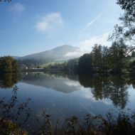
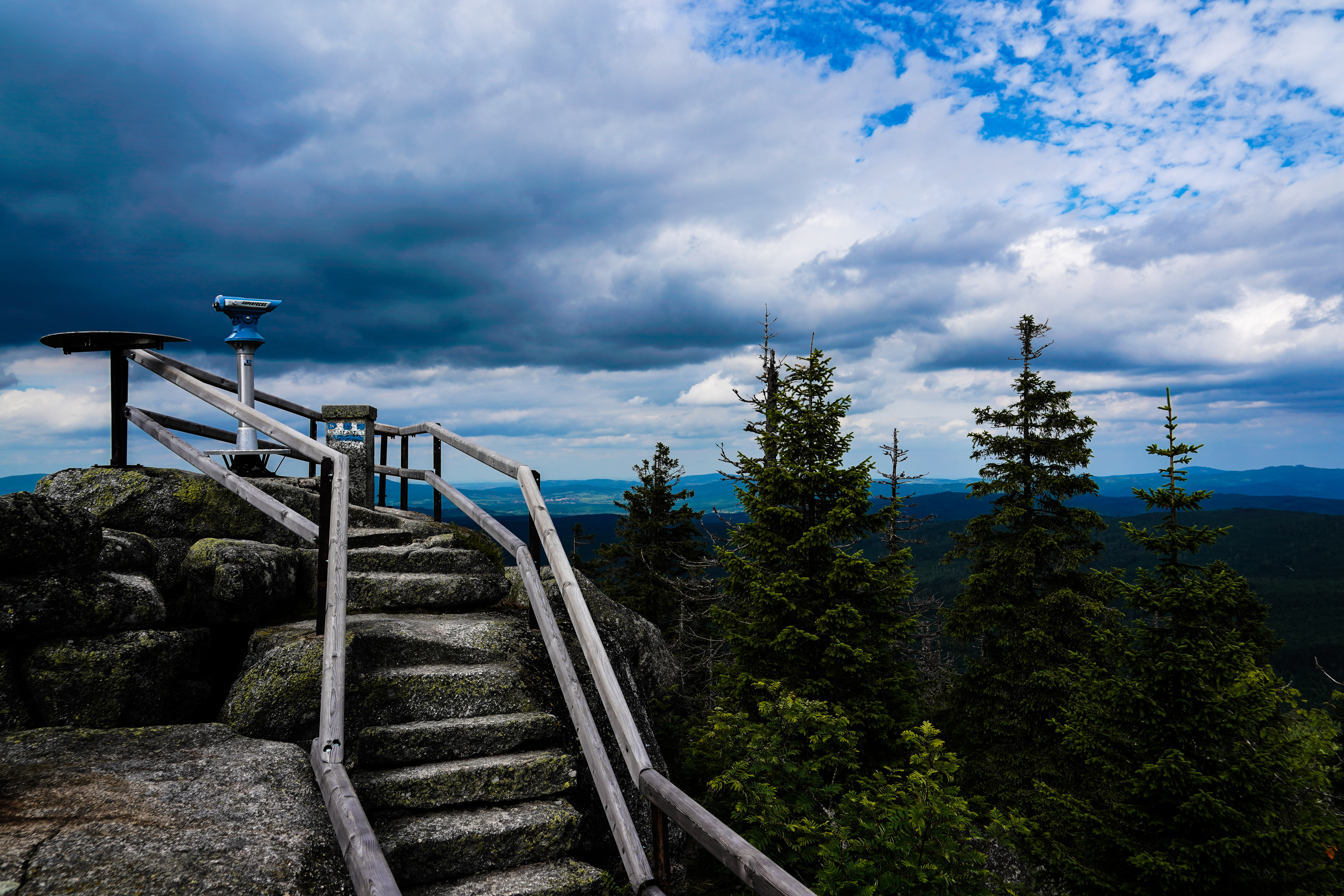
With its 1333 meters, the Dreisessel is the eighth highest mountain in the Bavarian Forest. In addition to the Lusen is also this mountain surrounded by legends. Once the kings of Bavaria, Bohemia and Austria gathered here on the top of the mountain to set the borders of their lands. Even today, the Dreisesselberg is considered a landmark for the border triangle Czech Republic, Austria and Germany. Compared to the other mountains of the Bavarian Forest, you can get very close to the summit by car . From the car park, a paved hiking trail leads to the summit, where a mountain restaurant calls for a stop. Thus, the Dreisessel is very much used as a destination for families with prams and older people. The 8 m high stone columns offer a magnificent view of the southeastern Bavarian Forest.
Hiking area Dreisessel in the Bavarian Forest
The hiking area around the Dreisessel is one of the most varied hiking areas of the Bavarian Forest. Here the hiker can choose between relatively easy tours of about 2 hours up to day trips of 6 hours ..
Hiking trails Dreisessel
Dreisessel – Hochstein
Start: Dreisesselparkplatz
Duration: approx. 1.5 hour (s)
From the parking lot leads the tarred trail to Dreisesselfelsen. Here you have the opportunity to use the mountain inn as a resting place. Continue to Hochstein with the summit cross. Here you have a good view of the Bavarian and Bohemian Forest in the east. We return to the chapel of the John Nepomuk Neuman, where church services are sometimes held – so-called mountain masses.
Dreisessel – Steinernes Meer – Dreiländereck
Start: Dreisesselparkplatz
Duration: approx. 2,5 hours
Starting point is again the parking lot. Leave the paved road at the junction Rosenberger Gut and after about 50 meters turn onto the famous Adalbert-Stifter-Steig. The Nordwaldkamm leads you towards the Steinernes Meer. After crossing the Steinernen Meer you reach the Seelensteig. Now it’s uphill towards Dreiländereck. The ridge takes you past Plöckenstein and back to the Dreisessel.
Altreichenau – Dreisessel
Start: Altreichenau Center
Duration: approx. 6 hours
From the center, it goes on the Klausgupferweg to the Adalbert Stifter bike path. After the crossing, it goes past the Fuchsenstein. After crossing the Brenner Bach, it’s now direction Michlklause. The further hiking trail leads steadily uphill. The Klausgupf can be reached via a narrow wooden staircase. Ewigkeitsstrasse and Bierstraßl are the distinctive path names here. After visiting the Hochstein and a rest in the mountain inn, it goes over Frauenberg back to Altreichenau.
Lackenhäuser/Rosenberger Gut – Dreisessel
Start: Lackenhäuser at Rosenberger Gut
Duration: approx. 4 – 5 hours
From the parking lot on the Ewigkeitsstraße, it goes on the Witikosteig to Dreisessel. After climbing the mountain you have the opportunity to visit the 8 m high stone columns on which kings have sat. From the Hochstein you have a good view of the Bavarian Forest and the neighboring Czech Republic.
The way back is via the Hochkammweg. Here you walk along the Czech border to Plöckenstein. On the Seesteig it goes down to the Stone Sea. Now it goes downhill to the end of the Hochstrasse. Now follow the direction of Lackenhäuser. The Witikosteig leads you directly back to the starting point.
Contact
Bayerischer WaldTourismusbüro Neureichenau
Dreisesselstraße 8
94089 Neureichenau
Tel.: +49 (0) 85 83/96 01-20
Fax: +49 (0) 85 83/96 01-10
New Paths – New Worlds: This project was funded by the European Union and the Passau Chamber of Commerce and the Wellness Hotels Bavaria